Celestial Cup Desktop Planisphere
An interactive, dual-layer celestial instrument designed by Sahra Industrial Design, overlaying starry constellations directly over terrestrial geography to reveal the mechanics of our rotating night sky.
The Instrument
Cosmos at Your Fingertips
A tactile, desktop planisphere combining an inner terrestrial map with an outer constellation overlay to model real-time celestial motion[cite: 3].
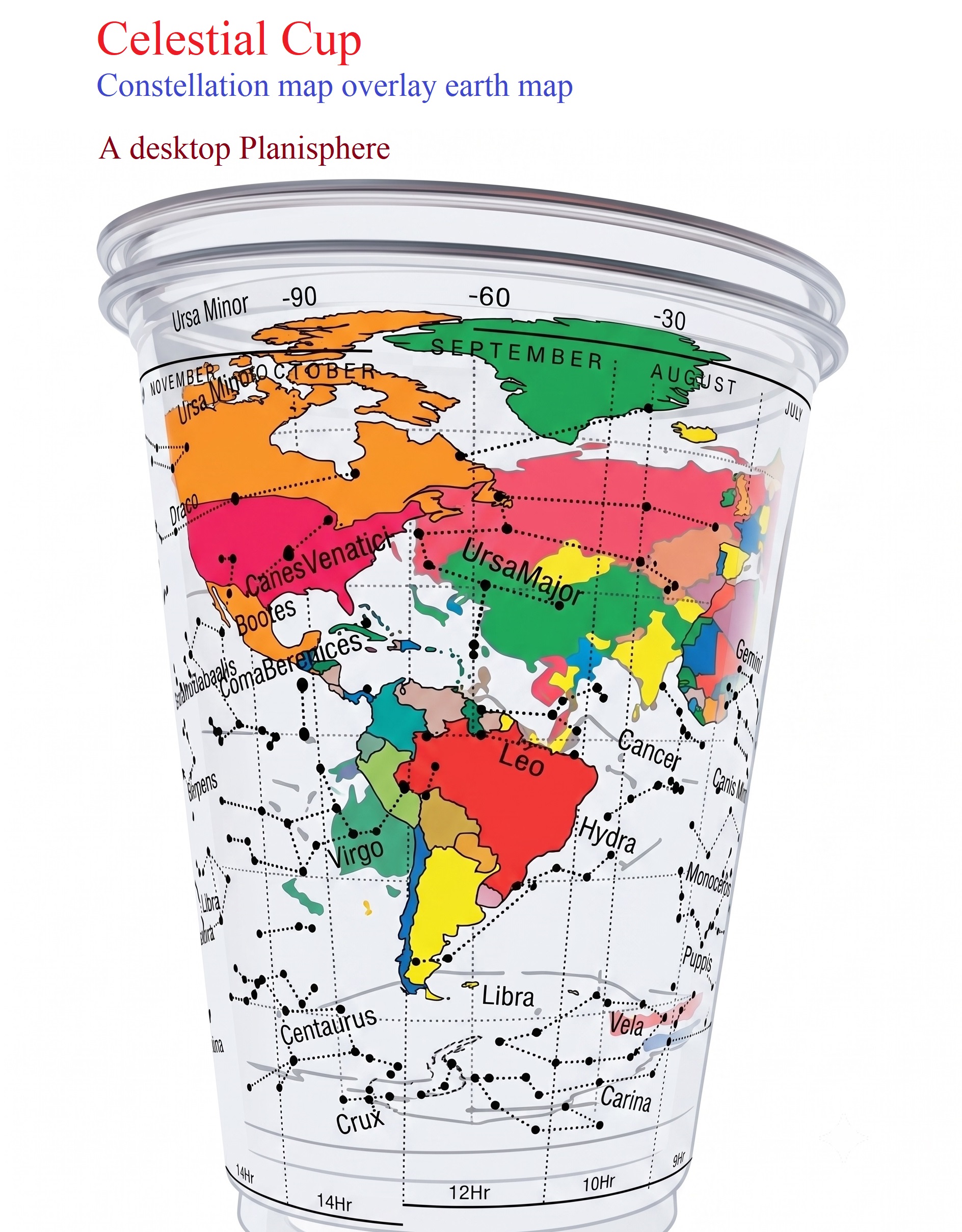
Dual Concentric Cylinder
Features independent, smooth concentric rotation, allowing observers to replicate Earth's diurnal rotation relative to fixed stellar coordinates.
Dual-Layer Mechanics
High-detail color-coded continents, latitude meridians, and reference geography showing global observer stations.
Precision transparent map depicting major stellar asterisms (Ursa Major, Leo, Virgo, Crux) and coordinate grids[cite: 3].
Upper rim annual month tracking aligned with base Right Ascension hour markings (10Hr, 12Hr, 14Hr) for date-specific targeting[cite: 3].
As the terrestrial cup rotates within the constellation shell, observers instantly grasp how Earth's spin creates the visual rise and transit of the stars.
Operations & Setup
Coordinate Alignment Matrix
| Layer | Reference | Alignment Function |
|---|---|---|
| Outer Glass | Stellar Dome | Constellations & RA Hours[cite: 3] |
| Inner Glass | World Map | Observer Longitude & Latitude |
| Upper Rim | Calendar Ring | Annual Month Matching[cite: 3] |
| Lower Base | Sidereal Scale | Local Solar Time Hours[cite: 3] |
1. Align your observer continent/city on the inner glass to the current calendar month on the rim[cite: 3].
2. Rotate the inner glass eastward to simulate nighttime Earth rotation.
3. Read which constellations sit directly overhead (at zenith) over your location throughout the night.